Developing a plant-survey method at Anap-Muput Forest Management Unit
Miyako Koizumi (Research Institute for Humanity and Nature)
There is global concern over sustainable development and mechanisms to provide incentives for the sustainable use of forests. There are two major problems in the development of such mechanisms. One is the economical problem of who and how to share costs and benefits. The other is the biological problem of how to evaluate ecosystems. The latter is considered highly challenging in tropical rainforests, where biodiversity is very high.
Biodiversity studies in tropical rainforests have been conducted by specialists, sometimes with the help of para-taxonomists. Their study sites are relatively small, usually less than 1 km2, because the number of specialists is limited and their objectives are to study biological or ecological processes. For the management of forests, however, a rapid and cost effective method to evaluate biodiversity is required. With such a practical method, users of the forests can make appropriate plans for the sustainable use of the forests.
The scope of my study in the project is to develop such type of practical method for the survey and evaluation of plant diversity in tropical rainforests of Sarawak. There are four steps in the study.
1) To develop a plot setting and sampling method that can cover a large area.
2) To develop a sorting-identification system.
3) To develop indicators of plant diversity.
4) To scale up the ground data using satellite images. The study site is the Anap-Muput Forest Management Unit, where sustainable forest management is pursued.
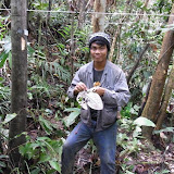
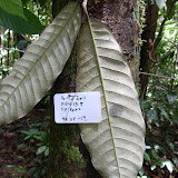
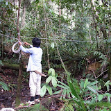
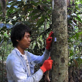
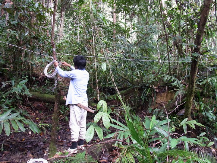
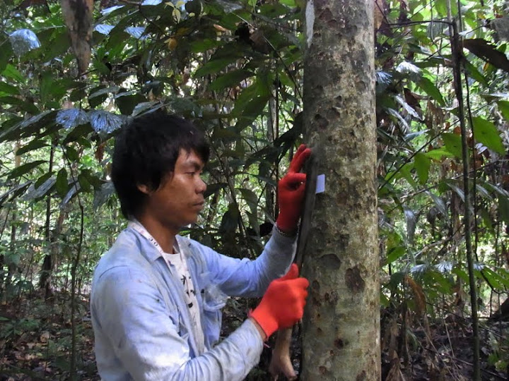
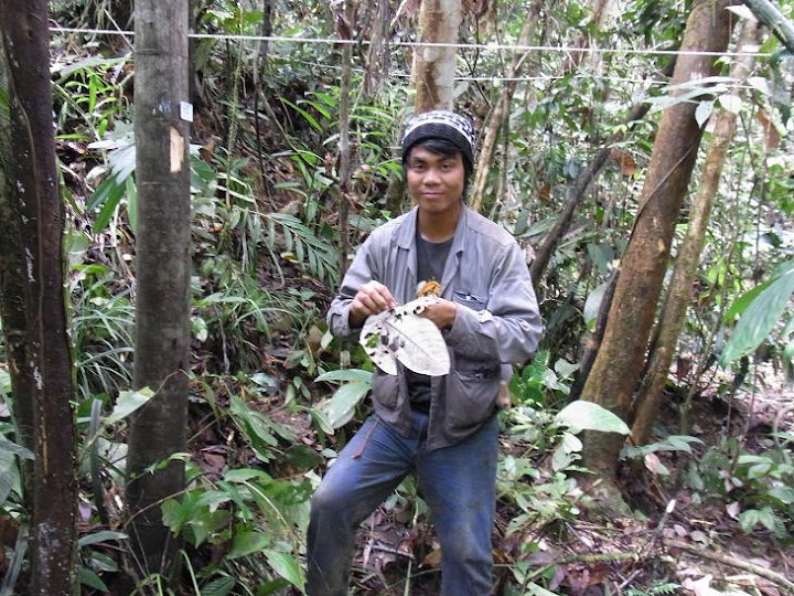
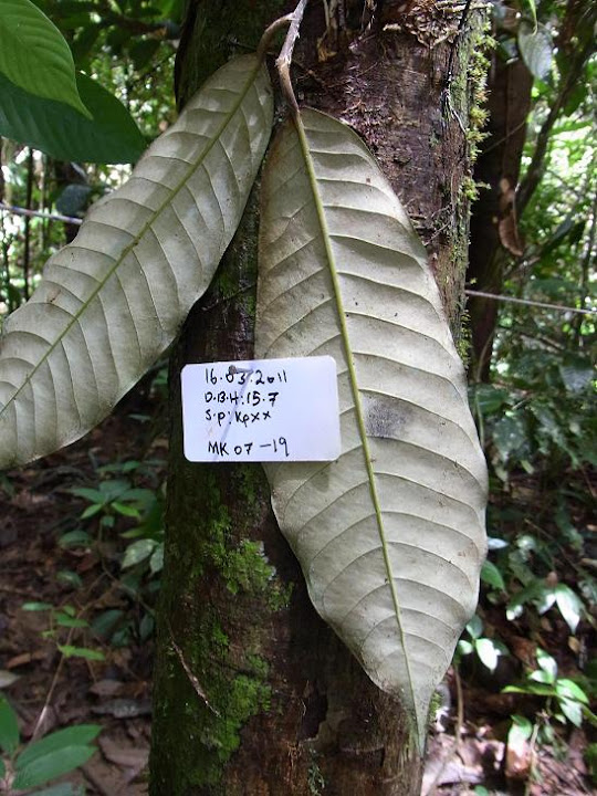
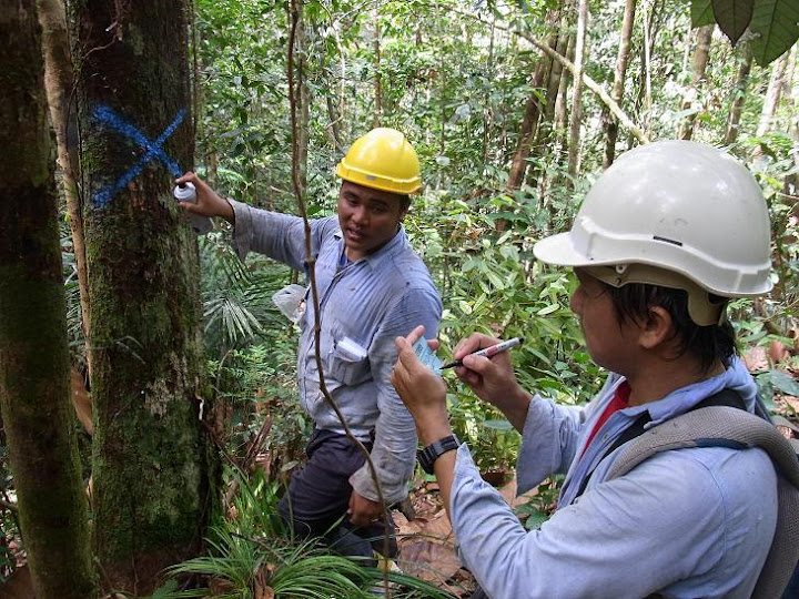
I made a first visit to the Anap-Muput Forest Management Unit from 8th to 19th March 2011. The purpose of the visit was to get a first-hand understanding of the site and conduct a preliminary plot survey before launching a full-scale one. The activities in this period were related to the first step mentioned above. I made seven small plots and collected samples with the help of Zedtee staff. Each plot was a circle with a radius of 15 m (0.0702 ha). Within the circle, trees of 10 cm or above in diameter at breast height (DBH) were tagged. For each tagged tree, DBH was measured, leaves were collected (usually by shooting small stones at the trees), and the bark and leaves were photographed. The Zedtee staff were used to plot work, and the survey was conducted smoothly.
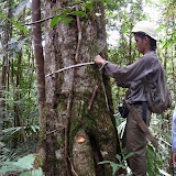
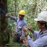
There were 36 – 56 trees surveyed in a plot. As far as I could check, sampling error of leaves by the staff occurred only for 0 – 1 tree/plot. Sampling of leaves was impossible (unless by climbing a tree) for 0 – 2 trees/plot. This time it took 3.5 – 4 hours to finish a plot because of my double checking of the samples. It would probably take less than 3 hours by two staff members without any such double checking.
Vegetation types were clearly reflected in the data from this simple survey. In agricultural fallows, several species dominated, and the tree size distribution was limited. In old forests, more species of various families were found, and there were larger size distributions. The problem is, however, that different types of vegetation exist in small patches. The arrangement of plots and careful use of satellite images will be the key in scaling up the result.


 The scope of my study in the project is to develop such type of practical method for the survey and evaluation of plant diversity in tropical rainforests of Sarawak. There are four steps in the study. 1) To develop a plot setting and sampling method that can cover a large area. 2) To develop a sorting-identification system. 3) To develop indicators of plant diversity. 4) To scale up the ground data using satellite images. The study site is the Anap-Muput Forest Management Unit, where sustainable forest management is pursued.
 I made a first visit to the Anap-Muput Forest Management Unit from 8th to 19th March 2011. The purpose of the visit was to get a first-hand understanding of the site and conduct a preliminary plot survey before launching a full-scale one. The activities in this period were related to the first step mentioned above. I made seven small plots and collected samples with the help of Zedtee staff. Each plot was a circle with a radius of 15 m (0.0702 ha). Within the circle, trees of 10 cm or above in diameter at breast height (DBH) were tagged. For each tagged tree, DBH was measured, leaves were collected (usually by shooting small stones at the trees), and the bark and leaves were photographed. The Zedtee staff were used to plot work, and the survey was conducted smoothly.

 There were 36 – 56 trees surveyed in a plot. As far as I could check, sampling error of leaves by the staff occurred only for 0 – 1 tree/plot. Sampling of leaves was impossible (unless by climbing a tree) for 0 – 2 trees/plot. This time it took 3.5 – 4 hours to finish a plot because of my double checking of the samples. It would probably take less than 3 hours by two staff members without any such double checking.
Vegetation types were clearly reflected in the data from this simple survey. In agricultural fallows, several species dominated, and the tree size distribution was limited. In old forests, more species of various families were found, and there were larger size distributions. The problem is, however, that different types of vegetation exist in small patches. The arrangement of plots and careful use of satellite images will be the key in scaling up the result.
There were 36 – 56 trees surveyed in a plot. As far as I could check, sampling error of leaves by the staff occurred only for 0 – 1 tree/plot. Sampling of leaves was impossible (unless by climbing a tree) for 0 – 2 trees/plot. This time it took 3.5 – 4 hours to finish a plot because of my double checking of the samples. It would probably take less than 3 hours by two staff members without any such double checking.
Vegetation types were clearly reflected in the data from this simple survey. In agricultural fallows, several species dominated, and the tree size distribution was limited. In old forests, more species of various families were found, and there were larger size distributions. The problem is, however, that different types of vegetation exist in small patches. The arrangement of plots and careful use of satellite images will be the key in scaling up the result.